 |
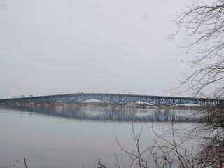
| South Grand Island bridges. In Tonawanda, facing Grand Island. |
Today’s post about the Grand Island bridges marks the start of a series about walking along the Niagara River. When you live on an island, as I do, you put a lot of thought as to how you are going to get on and off that island. In the past, the only way to travel to and from Grand Island was by ferry. Apparently, that was considered insufficient because, by the 1880s, island residents were campaigning for bridges to be built, to connect Grand Island with the mainland.
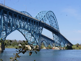 |
| Southbound Grand Island bridges. The view from Riverwalk, in Tonawanda. |
The campaign to get New York State to build the bridges took a while. Approximately fifty years after the campaign started, the first two Grand Island bridges were constructed.
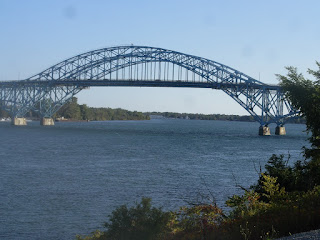 |
| This is the view of the south Grand Island bridges from East River Road, Grand Island. |
One of the bridges connects Grand Island with Tonawanda, and the other of the bridges connects Grand Island with Niagara Falls. The design of the bridges is a twin truss arch bridges. They are high enough so that a lake freighter and a tanker ship can pass below without colliding with the bottom of the bridges.
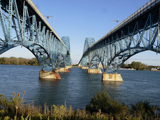 |
| Underneath the south Grand Island bridges on Grand Island. |
In the early 1960s, it was decided that, due to growth in Grand Island’s population and to increased traffic in general, it had become necessary to give each of Grand Island’s bridges a companion.
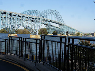 |
| This is the view of the bridges from Fisherman’s Wharf, Grand Island. |
So a second bridge was built: one to Niagara Falls and one to Tonawanda. The designers of the second bridge put a great deal of effort into creating bridges that looked like twins to the original ones.
 |
| As you head toward the peninsula in Buckhorn Island State Park, this is your view of the north bridge, connecting Grand Island to Niagara Falls. |
According to an article in Wikipedia, the main difference between the bridges is that the 1935 bridges had stone cutwaters on the piers, while the 1963 bridges had steel-faced cutwaters.
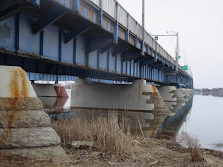 |
| Up close and personal: a view underneath the North Grand Island bridges. |
The bridges are truly a sight to behold, although I admit to having had a love-hate relationship with them. I once had a nightmare which featured me stranded on the very top of the bridge, screaming “help! help! help!” in a very movie-like sort of way. I was probably that petrified in my dream because I have a great fear of heights, and, so, am too phobic to walk over that bridge.
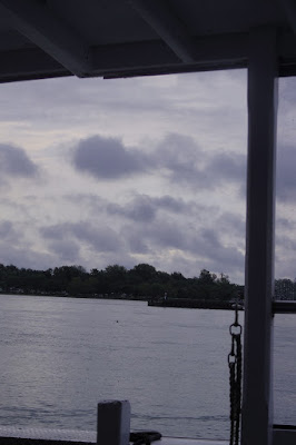 |
| view from the very fun ferry. |
One day, I had the opportunity to ride in a ferry from the River Oaks Marina, which is located in between the Whitehaven Cemetery and the Radisson Hotel Niagara Falls-Grand Island. I took a scenic six-mile walk to the boat launch and then hopped onto a boat, which took me across the river and into the canal. It was fun and it was scenic. Unfortunately, that ferry service did not continue.
Tomorrow: the walk from River Road to Gateway Park in the City of Tonawanda.
Indeed, the sight of the bridge is a thing to behold. beautiful bridge and can relate to the dream!
I went to school in Rochester, NY and had many road trips to the Falls and Canada. The bridges in that area seem to be massive!
Thanks for the memories as well as the history lesson! And, on that note, I have never heard of a bridge or other structure that was 'downsized' – there always seems to be more people traveling and needing bigger bridges and roadways.
Great content! Love the history and the beautiful pictures.
What breathtaking views Alice! Love all your photos but sure makes me homesick for good old New York scenery and weather!
I am fortunate – with the various fears I have, bridges are not one of them. I love walking across them. I've walked from Niagara Falls United States to the Canadian side, from Ottawa, Ontario to Hull, Quebec, from Manhattan to Brooklyn on the Brooklyn Bridge, from Charleston, South Carolina to…well, you get the picture. I loved those pictures and the different perspectives.